
GLO Resources - Original Island Surveys
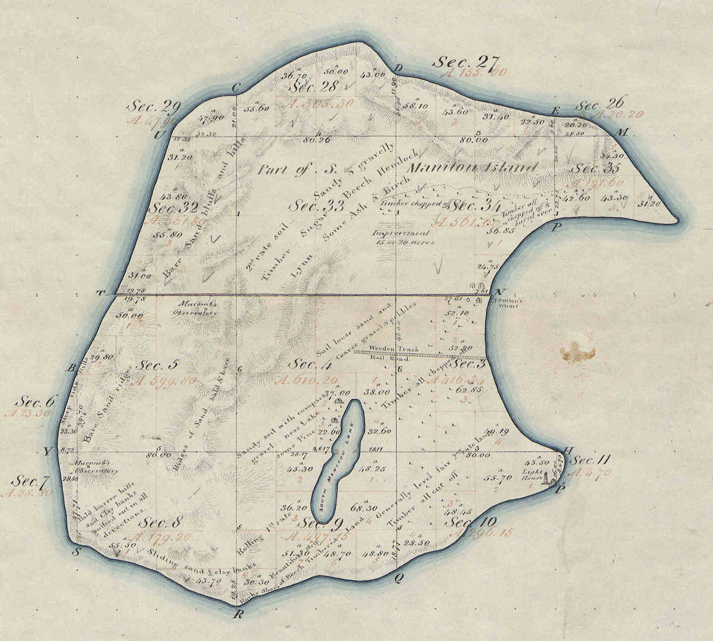
North and South Manitou Islands were originally surveyed by Orange Risdon and his crew in the summer of 1847, as described in the article Orange Risdon and the Original Islands Survey
The materials and information listed below have been made available by the General Land Office (GLO), U.S. Bureau of Land Management - Eastern States, and others as noted.
Orange Risdon Survey Maps
Note: Maps are MrSID compressed images. Download Windows browser plug-in.
 Township 32 North, Range 15 West Northwest Part of North Manitou Island
- Township 32 North, Range 14 West Northeast Part of North Manitou Island
- Township 31 North, Range 15 West Southwest Part of North Manitou Island & North Part of South Manitou Island
- Township 31 North, Range 14 West Southeast Part of North Manitou Island
- Township 30 North, Range 15 West South Part of South Manitou Island
- Township 30 North, Range 15 West South Manitou Island ~ "Sandy Point" detail (lighthouse reservation)
Orange Risdon Survey Field Notes
- • Township 32 North, Range 15 West Northwest Part of North Manitou Island
- • Township 32 North, Range 14 West Northeast Part of North Manitou Island
- • Township 31 North, Range 15 West Southwest Part of North Manitou Island & North Part of South Manitou Island
- • Township 31 North, Range 14 West Southeast Part of North Manitou Island
- • Township 30 North, Range 15 West South Part of South Manitou Island
Helpful Literature
- • Glossary of Terms Associated with Land Patents
- • About Land Entry Files of the General Land Office
- • Land Survey and Mapping: An Introduction for Woodland Owners